Stay cool, Houston. An Extreme Heat Warning is in effect for this Wednesday. In place from 11 am – 8 pm, the U.S. National Weather Service warns of dangerously high temperatures up to 104, with feels like temperatures soaring up to 115.
The Extreme Heat Warning is in effect from 11 am to 8 pm Wednesday for coastal and inland parts of Harris County, including Central Houston. Afternoon highs in the Houston area are forecast to peak between 102 and 104 degrees.
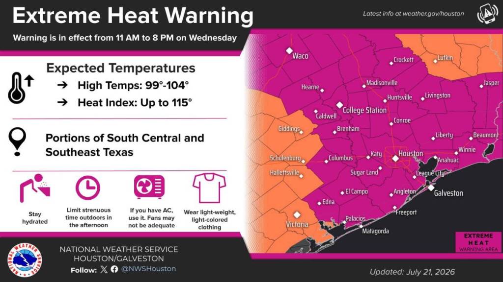
Factoring in humidity, heat index values are expected to reach 110 to 115 degrees, with isolated higher peaks possible in nearby communities.
The upper-end values will concentrate in the following areas:
- Inland Harris County
- Montgomery County (The Woodlands)
- Fort Bend County (Sugar Land/Richmond)
- Waller County
- Brazos County
Meteorological outlets issue an Extreme (or Excessive) Heat Warning alerts the public to a high probability of heat-related illnesses, such as heat stroke, regardless of a person’s general health or fitness level.
As far as precautions, experts recommend limiting strenuous outdoor activity while the warning is in effect. If you must, it’s better to do so in the morning or at night with frequent breaks either in A/C or in the shade while drinking plenty of water.
Light-colored, loose-fitting clothing is recommended. If you know someone, be sure to check on older adults with chronic conditions. Do not leave children or pets in vehicles.
The remainder of the week in Houston is forecasted to be very hot and dry for the most part. This coming weekend in Houston looks hot, humid, and somewhat unsettled, with more clouds and a better chance of thunderstorms than earlier in the week.
Saturday is expected to be mostly cloudy, which may keep temperatures slightly lower with heat or humidity. Sunday’s forecast calls for the possibility of an afternoon thunderstorm, fitting the typical midsummer Gulf Coast pattern of scattered, pop‑up storms developing later in the day.